Add your own picture and explain the route, parking, gates, paths or landmarks that help people find it.
Earn 5 points after the picture is checked and accepted.
Add your photo and local directionsShare what you foundWhat is recorded here
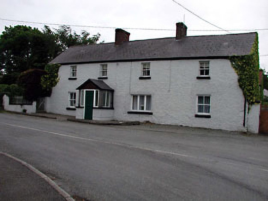
Detached four-bay two-storey house, c.1850, on an L-shaped plan retaining early fenestration with four-bay single-storey return to rear south-east. Renovated, c.1970, with single-bay single-storey gabled projecting porch added to front and some openings remodelled to return. Gable-ended roofs with slate. Clay ridge tiles. Red brick chimney stacks. Cast-iron rainwater goods. Gabled to porch. Artificial slate. Concrete ridge tiles. Iron rainwater goods. Roughcast walls. Painted. Grey brick piers to porch with timber panelling to gable. Square-headed openings. Stone sills 2/2 timber sash windows (some replacement timber casement windows, c.1970, to remodelled openings to return). Timber fixed-pane windows to porch. Timber panelled door. Sidelights. Road fronted. Tarmacadam verge to front. Attached four-bay double-height outbuilding, c.1850, at right angles to south-east. Reroofed, c.1950. Gable-ended roof. Replacement corrugated-iron, c.1950. Iron ridge tiles. Roughcast walls. Unpainted. Square-headed openings. Timber fittings.
This official record and map point do not grant access. Most recorded buildings are privately owned; view them only from public ground unless the owner allows entry.