Add your own picture and explain the route, parking, gates, paths or landmarks that help people find it.
Earn 5 points after the picture is checked and accepted.
Add your photo and local directionsShare what you foundWhat is recorded here
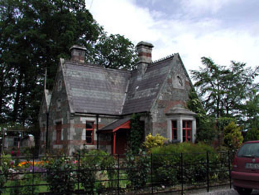
Detached two-bay single-storey former gate lodge, c.1880, on an L-shaped plan with single-bay single-storey gabled projecting bay to right having single-bay single-storey canted bay window to ground floor, canted entrance bay to corner formed by projection and single-bay single-storey return to rear to north-west having single-bay single-storey lower projecting bay to south-west. Now in private residential use. Gable-ended roofs on a T-shaped plan with slate (lean-to over entrance bay; gabled to lower projecting bay). Courses of scalloped slate. Decorative crested ridge tiles. Cut-stone chimney stacks with red brick dressings. Cut-stone coping to gables. Cast-iron rainwater goods on cut-stone eaves course. Rubble stone walls. Cut-granite quoins to corners. Red brick stringcourses. Cut-granite blind trefoil panels to gables. Square-headed openings (including canted bay window). Cut-granite sills, surrounds and lintels. Timber casement windows. Square-headed door opening behind open timber porch. Timber panelled door. Set back from road in grounds originally part of Harristown House estate adjacent to former avenue. Landscaped grounds to site. Gateway, c.1880, to south-east comprising four cut-granite profiled piers with raised armorial plaques, pyramidal capping with saw-tooth detailing, decorative cast-iron double gates, flanking pedestrian gates and rubble stone curved flanking walls with cut-granite stringcourse incorporating quatrefoil motifs and cut-granite coping having iron protective finials. Rubble stone boundary wall to remainder of site.
This official record and map point do not grant access. Most recorded buildings are privately owned; view them only from public ground unless the owner allows entry.