Add your own picture and explain the route, parking, gates, paths or landmarks that help people find it.
Earn 5 points after the picture is checked and accepted.
Add your photo and local directionsShare what you foundWhat is recorded here
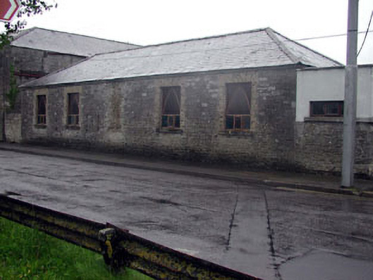
Attached five-bay double-height rubble stone building, c.1850, originally detached. Renovated and extended, c.1980, comprising single-bay double-height lower flat-roofed end bay to right (south-west) on a canted plan incorporating fabric of former boundary wall. Hipped roof with slate. Clay ridge tiles. No rainwater goods. Flat-roofed to additional bay behind parapet wall. Materials not visible. Random rubble stone walls. Section to centre rebuilt, c.1980, with yellow brick. Yellow brick course to eaves. Random rubble stone walls to part of additional bay (originally boundary wall). Rendered walls over. Painted. Cut-stone coping to parapet wall with cross finial. Square-headed openings. Replacement concrete sills, c.1980, to original block. Yellow brick block-and-start surrounds. Replacement timber casement windows, c.1980, with Gothic-style timber tracery. Timber panelled door, c.1980, to additional bay. Road fronted with additional bay forming corner. Concrete footpath to front.
This official record and map point do not grant access. Most recorded buildings are privately owned; view them only from public ground unless the owner allows entry.