Add your own picture and explain the route, parking, gates, paths or landmarks that help people find it.
Earn 5 points after the picture is checked and accepted.
Add your photo and local directionsShare what you foundWhat is recorded here
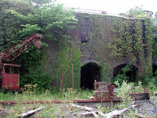
Detached three-bay two-storey rubble stone mash tun house, c.1830, with segmental-headed integral carriageways to ground floor and yellow brick chimney stack to west on a circular plan. Reroofed, c.1940. Now disused and in ruins. Gable-ended roof. Replacement corrugated-iron, c.1940, on steel truss construction. Rainwater goods not visible. Random rubble stone walls. Yellow brick quoins to corners. Yellow brick chimney stack to west on a circular plan. Now overgrown. Segmental-headed integral carriageways to ground floor. Yellow brick dressings. Fittings now gone. Remains of square-headed openings to first floor. Yellow brick dressings. Fittings now gone. Interior (compartmentalised into full-height voids) now in ruins. Rubble stone internal walls. Yellow brick arcaded partition wall on yellow brick pier. Remains of yellow brick-lined still emplacement on a circular plan. Set back from road in grounds shared with distillery buildings. Remains of freestanding metal-sheeted mash tun to south-west on a circular plan. Now overgrown.
This official record and map point do not grant access. Most recorded buildings are privately owned; view them only from public ground unless the owner allows entry.