Add your own picture and explain the route, parking, gates, paths or landmarks that help people find it.
Earn 5 points after the picture is checked and accepted.
Add your photo and local directionsShare what you foundWhat is recorded here
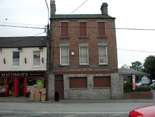
End-of-terrace three-bay three-storey double-pile red brick house, c.1845, retaining early fenestration to first floor with yellow brick side elevation to north-east. Renovated and extended, c.1975, comprising four-bay two-storey flat-roofed return to rear to north-west with openings remodelled to ground floor to accommodate commercial use. Reroofed, c.1995. Now disused. Gable-ended double-pile (M-profile) roof. Replacement felt, c.1995. Rendered chimney stacks. Cast-iron rainwater goods of yellow brick eaves course. Flat-roof to return. Replacement felt, c.1995. Red brick Flemish bond walls. Yellow brick Flemish bond walls to side (north-east) elevation. Replacement rubble granite cladding to ground floor. Rendered walls to return. Painted. Square-headed openings (remodelled, c.1975, to ground floor). Stone sills and lintels (concrete sills to return). Early 1/1 timber sash windows to first floor. Boarded-up to remainder (including to return). Road fronted. Concrete brick footpath to front. Tarmacadam carpark to north-east.
This official record and map point do not grant access. Most recorded buildings are privately owned; view them only from public ground unless the owner allows entry.