Add your own picture and explain the route, parking, gates, paths or landmarks that help people find it.
Earn 5 points after the picture is checked and accepted.
Add your photo and local directionsShare what you foundWhat is recorded here
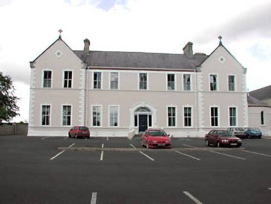
Detached nine-bay two-storey former convent, c.1890, on an almost-symmetrical plan retaining early aspect comprising five-bay two-storey central block with segmental-headed door opening to centre, two-bay two-storey gabled advanced end bays, three-bay two-storey side elevations to north-east and to south-west having two-bay single-storey bowed projecting bay to north-east (probably incorporating chapel) and four-bay two-storey return to rear to north-west. Now in use as offices. Gable-ended roofs with slate (gable-fronted to advanced end bays; half-conical to bowed projecting bay). Clay ridge tiles. Rendered chimney stacks. Cut-stone coping to gables with cross finials. Cast-iron rainwater goods. Rendered walls. Ruled and lined. Painted. Rendered quoins to corners. Moulded rendered string/sill course to both floors. Rendered band to eaves with moulded red brick course over. Square-headed window openings (round-headed to bowed projecting bay). Rendered sills (forming continuous sill course). Rendered surrounds with keystones. 2/2 timber sash windows. Segmental-headed door opening. Rendered surround with keystone having hood moulding over. Timber pilaster doorcase with consoles. Timber panelled door approached by flight of steps. Sidelights. Decorative fanlight. Set back from road in own grounds. Tarmacadam forecourt/carpark to front.
This official record and map point do not grant access. Most recorded buildings are privately owned; view them only from public ground unless the owner allows entry.