Add your own picture and explain the route, parking, gates, paths or landmarks that help people find it.
Earn 5 points after the picture is checked and accepted.
Add your photo and local directionsShare what you foundWhat is recorded here
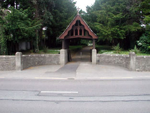
Graveyard with various cut-stone grave markers, c.1850-present. Remains of detached rubble stone medieval church, c.1600, to south comprising single-bay four-stage tower on a square plan with round-headed openings to parapet. Now in ruins. Roof now gone. Rubble stone walls including advanced sections to upper stage. Square-headed opening to first stage. No dressings or fittings. Round-headed openings (paired) to upper stage. Rubble stone voussoirs. No fittings. Overgrown grounds surrounding. Gateway, c.1850, to south comprising pair of rubble stone circular piers with cut-stone capping and wrought iron gates having rubble stone curved flanking walls including steps (four) to stile. Lych gate, c.1920, to east comprising cut-stone plinth walls, timber piers over having gabled canopy with decorative timber work to gable and cross finial to apex. Rubble stone curved flanking walls with cut-stone piers.
This official record and map point do not grant access. Most recorded buildings are privately owned; view them only from public ground unless the owner allows entry.