Add your own picture and explain the route, parking, gates, paths or landmarks that help people find it.
Earn 5 points after the picture is checked and accepted.
Add your photo and local directionsShare what you foundWhat is recorded here
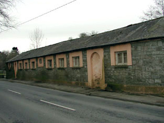
Detached ten-bay single-storey national school, dated 1845, on a bow-ended symmetrical plan; three-bay single-storey side elevations. Now disused. Bow-ended hipped slate roof with clay ridge tiles, and cast-iron rainwater goods on rendered eaves. Repointed coursed or snecked limestone walls originally roughcast on rendered chamfered plinth. Square-headed window openings centred on cut-limestone date stone ("1845") with cut-granite sills, and rendered surrounds framing timber casement windows behind wrought iron bars. Pair of round-headed flanking door openings with rendered surrounds framing "fanlight"-detailed rendered infill. Pointed-arch door openings (side elevations) with rendered block-and-start surrounds framing rendered infill. Pointed-arch flanking window openings with cut-limestone sills, and rendered block-and-start surrounds framing timber casement windows behind wrought iron bars. Road fronted with concrete footpath to front.
This official record and map point do not grant access. Most recorded buildings are privately owned; view them only from public ground unless the owner allows entry.