Add your own picture and explain the route, parking, gates, paths or landmarks that help people find it.
Earn 5 points after the picture is checked and accepted.
Add your photo and local directionsShare what you foundWhat is recorded here
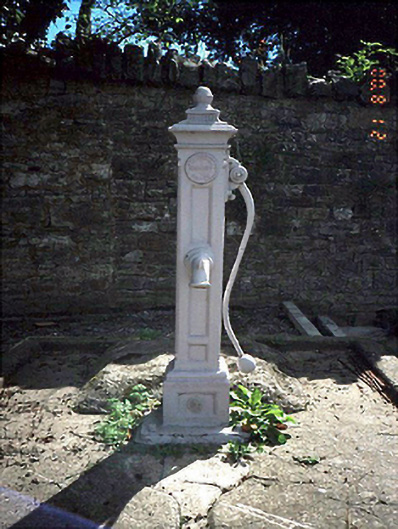
Freestanding cast-iron "cow tail" waterpump, installed 1922, on a square plan with panelled shaft on panelled pedestal having acorn finial-topped fluted capping. Disused, 2000. Repositioned, 2014. Restored, 2020. Street fronted on concrete footpath. NOTE: The waterpump, supplied by Tonge and Taggart (established 1869) of Dublin and distinguished by a ball finial handgrip, was installed to a specification by Anthony Scott (c.1844-1919), Architect and Engineer to Balrothery Rural District Council (appointed 1906), on foot of 'a memorial submitted by...a number of residents for the provision of a pump' in addition to the waterpump previously installed (1914) outside the dispensary (The Drogheda Argus and Leinster Journal 13th September 1919). However, the water from the pump had a rusty discolouration, pointing to a faulty lining, and villagers preferred to get their supply from the earlier waterpump (pers. conn. 2020). Castings include the emblem of Balrothery Rural District Council (established 1898; abolished 1925) and the "Déanta I nÉirinn" emblem created (1907) by the Irish Industrial Development Association and the first trademark registered in Ireland under the Industrial and Commercial Property (Protection) Act, 1927. The waterpump was restored by Naul Community Council in 2020 with funding from The Heritage Council under the Community Heritage Grant Scheme.
This official record and map point do not grant access. Most recorded buildings are privately owned; view them only from public ground unless the owner allows entry.