Add your own picture and explain the route, parking, gates, paths or landmarks that help people find it.
Earn 5 points after the picture is checked and accepted.
Add your photo and local directionsShare what you foundWhat is recorded here
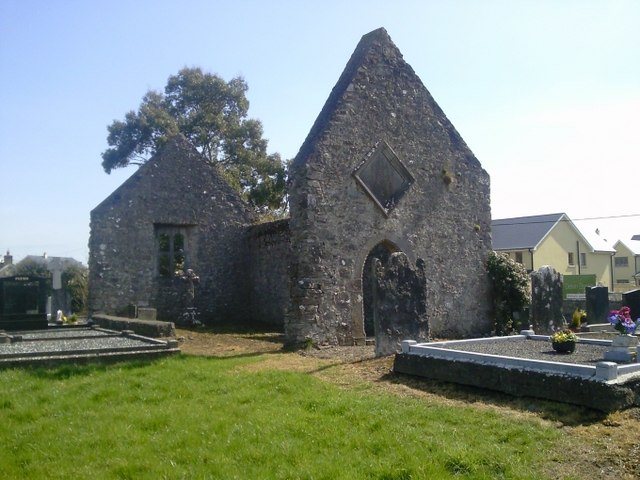
Remains of freestanding single-bay single-storey single-cell chapel, dated 1710, on a rectangular plan. Now in ruins. ROOF: None. WALLS: Repointed rubble stone battered walls with rough edged limestone flush quoins to corners. OPENINGS: Pointed-arch door opening (west) below cut-limestone diagonal date stone ("1710") with cut-limestone step threshold, and margined tooled rough edged limestone block-and-start doorcase having cable moulded reveals. Ogee-headed window opening in bipartite arrangement (east) with cut-limestone cruciform mullion, and margined tooled cut-limestone block-and-start surround having chamfered reveals with hood moulding. INTERIOR: Ruin. SITE: Set in graveyard with repointed rubble limestone boundary wall to perimeter having rendered rounded coping. GENERAL: A diagonal date stone similar to the date stone on the Catholic Church of the Nativity of Our Lady (see 11803001) is inscribed: "THIS CHAPEL AND MONUMENT/WAS ERECTED BY THE HONble COl/EDWARD HUSSEY OF WEST/OUNE [sic] AND HIS LADY/MADAM MABLE HUSSEY ALS BARNE/WALL FOR THEIRE [sic] USE/AND POSTERITY IN/THE YEAR OF OUR/LORD GOD/1710". The chapel reused the door and window of an adjacent medieval church cleared to make way for a new church (1814) described (1837) as 'a plain neat building' (Lewis 1837 II, 421) [SMR DU004-045004-].
This official record and map point do not grant access. Most recorded buildings are privately owned; view them only from public ground unless the owner allows entry.