Add your own picture and explain the route, parking, gates, paths or landmarks that help people find it.
Earn 5 points after the picture is checked and accepted.
Add your photo and local directionsShare what you foundWhat is recorded here
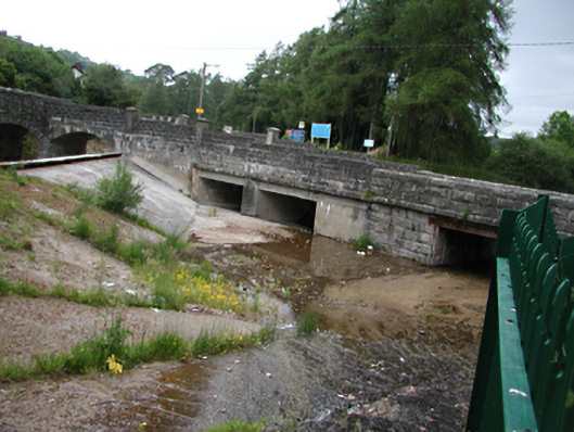
Multiple-span stone and concrete road bridge, built in 1906 over a concrete spillway. Abutting western section, two-arched stone bridge across the Artificial Watercourse containing River Dodder, c.1885. To east, four flat trabeated openings in rusticated coursed granite ashlar walls. River diverted to north-east by concrete sill in its bed, forming spillway for floodwater. Inscribed plaques to parapets. 'The former bridge was destroyed by a flood on 25th April 1905' on west. 'Castlekelly Bridge rebuilt in February 1906,' to east. Square piers set in walls. Western section, twin segmental-arches of rusticated ashlar over channel to Artificial Watercourse to Lower Reservoir. Steps in riverbed above and below bridges.
This official record and map point do not grant access. Most recorded buildings are privately owned; view them only from public ground unless the owner allows entry.