Add your own picture and explain the route, parking, gates, paths or landmarks that help people find it.
Earn 5 points after the picture is checked and accepted.
Add your photo and local directionsShare what you foundWhat is recorded here
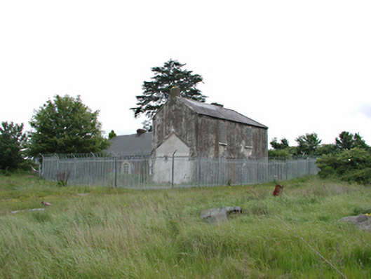
Detached multiple-bay two-storey L-plan former farmhouse, c.1840, now derelict. Four-bay single-storey wing to east, blocked and shuttered openings, in rubble and roughcast walls. Corrugated plastic roof. Two-storeys to north with blocked openings. Pitched slate roof. Foundations and remnants of demolished annexes. Surrounded by steel picket fence. Derelict single-storey gate lodge set inside boundary wall.
This official record and map point do not grant access. Most recorded buildings are privately owned; view them only from public ground unless the owner allows entry.