Add your own picture and explain the route, parking, gates, paths or landmarks that help people find it.
Earn 5 points after the picture is checked and accepted.
Add your photo and local directionsShare what you foundWhat is recorded here
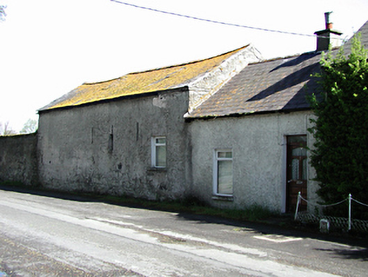
Formerly detached farm outbuilding, c.1775, partly converted for domestic use and extended to south, c.1930. Coursed rubble limestone walls, roughcast rendered to road, with three slit openings and later window opening having uPVC window. uPVC window and timber door to southern roughcast rendered extension. Pitched slate roofs, single chimney stack. Rubble stone outbuilding to north with blocked openings and lean-to slate roof. Coursed limestone rubble wall to north with limestone ashlar granite capped gate piers.
This official record and map point do not grant access. Most recorded buildings are privately owned; view them only from public ground unless the owner allows entry.