Add the human story, a picture, a first-hand message or a missing place.
Earn 5 points after the picture is checked and accepted.
Add a pictureAdd its storyTalk or ask a questionAdd a new placeWhat is recorded here
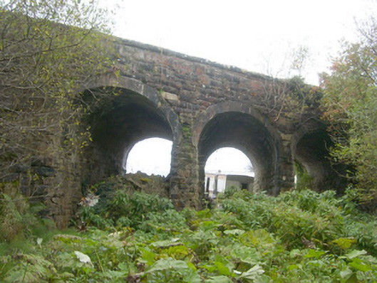
Triple-arch railway bridge, built c. 1893, carrying road over the former Donegal Town to Killybegs narrow gauge railway line. Railway lines no out of use with tracks removed (c. 1960). Three concrete segmental-headed arches having concrete lining to arch barrels. Squared and coursed mildly rock-faced rubble sandstone construction to pier abutments, spandrels and to parapets. Dressed margins to abutments; rock-faced sandstone coping over parapets. Coursed and squared rubble sandstone buttresses to either end of the bridge on the south elevation. Located to the south-east of Mountcharles and to the north-east of the former Mountcharles Railway Station (altered and not in survey). Storage yard adjacent to bridge to the south.
This official record and map point do not grant access. Most recorded buildings are privately owned; view them only from public ground unless the owner allows entry.
Conversation about this place
Questions and messages sit beneath the source record. They are checked before appearing.
No questions or messages yet.
Ask a question or join the conversation