Add the human story, a picture, a first-hand message or a missing place.
Earn 5 points after the picture is checked and accepted.
Add a pictureAdd its storyTalk or ask a questionAdd a new placeWhat is recorded here
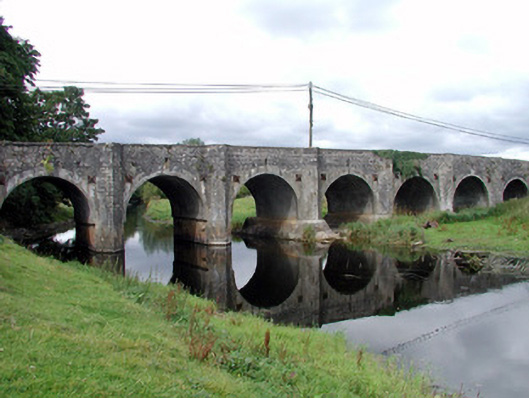
Twelve-arch limestone bridge, built c.1750, carrying main Roscommon-Galway road over River Suck. Comprising random coursed stone walls, dressed voussoirs to arch-rings and full-height V-cut-waters to both up and downstream elevations and rising without break to level of parapets. Westernmost arch blocked up with limestone rubble. Pedestrian refuges to parapet. Parapet copings have slabs laid flat giving neat finish. Slight rise in bridge surface and arches increase in size towards centre of bridge. Slit opening over each arch for draining road surface. Soffits of arches all gunnelled. Tie-plates to each side of arches. Wrought-iron kissing gate to north-east within wall giving access to river's edge.
This official record and map point do not grant access. Most recorded buildings are privately owned; view them only from public ground unless the owner allows entry.
Conversation about this place
Questions and messages sit beneath the source record. They are checked before appearing.
No questions or messages yet.
Ask a question or join the conversation