What is recorded here
Huggard is a rectangular earthwork beside Liscarroll Castle in County Cork, Ireland. It stretches about 150 metres north-south and 165 metres east-west, with a fosse on the east, a drain on the north and a field fence on the west. The shape suggests people worked the land there repeatedly, perhaps growing food or keeping animals close to the castle.
This earthwork was referred to in the 'Archaeological Inventory of County Cork - vol. 4 North Cork' (2000, 520-21) under the entry (no. 14335) for Liscarroll Castle (CO016-015001-). The reference to the earthwork in the entry is as follows:
'Rectangular area (c. 150m N-S; c. 165m E-W) adjoining N side of curtain wall marked 'Hugard' on 1937 OS 6-inch map; defined by hachured fosse to E, drain to N and field fence to W.'
The above description is derived from the published 'Archaeological Inventory of County Cork. Volume 4: North Cork' (Dublin: Stationery Office, 2000). In certain instances the entries have been revised and updated in the light of recent research.
Date of upload/revision: 14 January 2009
The monument record does not grant public access. Check the route and ask the landowner before entering private land.
- What survives
- Recorded monument
Places near here
 LiscarrollArchaeological place · 69 yd
 Liscarroll (Site of)Enclosure · 94 yd
 Liscarroll CastleCastle · 154 yd
 Battle of LiscarrollMajor battlefield · 241 yd
 Ch (in Rns)Church · 281 yd
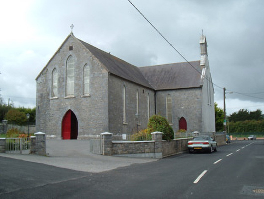 Saint Joseph's Churchchurch/chapel · 360 yd
 Windmill HillMountain / peak · 2.9 mi
 Castle (Site of)Castle, unclassified · 3.0 mi
 Churchtown TrailsVisitor information · 3.2 mi
 Lady's WellSpring · 3.2 mi
 Ballyhoura WayWalking route · 4.1 mi
 European YewEuropean Yew · 6.3 mi