What is recorded here
Knockash holds a collapsed stone ringfort where human hands once shaped a living boundary. Quarrying has bitten into the north and east, reducing the wall to a grass-covered bank, yet a square annexe still abuts the main circle like a forgotten room. The site sits twenty-five metres from a larger hillfort, suggesting a layered settlement rather than a single isolated home. What remains is enough to show that people lived, worked and marked ownership on this slope before modern tools erased the edge.
On a N-facing slope in rough pastureland, some 250m to the NE of a hillfort (GA115-042----). This poorly preserved subcircular cashel (36.8m N-S; 32.5m E-W) is defined by a collapsed drystone wall, which is reduced to a grass-covered stony bank. Some wall-facing is evident at SE and a large boulder is visible at SW. An almost square annexe (E-W 14m; N-S 13m) abuts the cashel wall at N. Quarrying has encroached upon the monument at N and NE. A series of banks and cultivation ridges are visible to the NW.
Compiled by: Galway Archaeological Survey, UCG
Date of upload: 10 January 2018
The monument record does not grant public access. Check the route and ask the landowner before entering private land.
- What survives
- Recorded monument
Places near here
 TobermacduaghHoly well · 180 yd
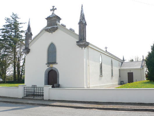 Saint Mary's Catholic Churchchurch/chapel · 1194 yd
 R.C. Chapel and School Ho.Chapel · 1253 yd
 CaveMan-made underground passage · 1704 yd
 Stone Islands SouthIslet · 2.0 mi
 Island McCooIslet · 2.2 mi
 Ballynamantragh CastleCastle, unclassified · 2.2 mi
 Long PointHeadland · 2.2 mi
 Castle (in ruins)Castle, tower house · 2.7 mi
 Scalpeen RockNamed rock · 4.2 mi
 Dartfield Horse MuseumHeritage attraction · 5.2 mi
 Derrybrien Bog SlideHeritage attraction · 5.5 mi