What is recorded here
No one knows when the circle closed or who stood inside it, but the scarp still cuts through Knockannacreeva like a forgotten decision. It sits beside Patrick’s Well and the ringfort, waiting for rain or memory to make them speak together. The land has changed owners and shapes, yet the enclosure keeps its own quiet claim.
In reclaimed poorly drained pasture, 75m NE of a stream which marks townland boundary with Coolrus. ‘Patrick’s Well’ ( LI038-092---- ) and ringfort (LI038-089----) lie 140m and 210m to the SW respectively. Not marked on the 1840 ed. OSi 6-inch map. Depicted on the 1897 ed. OSi 25-inch map as circular-shaped platform (dims. c. 31m N-S; 32m E-W) defined by a scarp. Monument visible as circular-shaped cropmark truncated at SE and SW by a field boundary running E-W on OSi orthophotograph taken between 2005-12 and on Google Earth orthoimages.
See attached Google Earth orthoimages.
Compiled by: Fiona Rooney
Date of upload: 19 April 2021
The monument record does not grant public access. Check the route and ask the landowner before entering private land.
- What survives
- Recorded monument
Places near here
 Patricks WellHoly well · 186 yd
 Kilbreedy Burial Gd (for Children)Children's burial ground · 1189 yd
 Church (in ruins)Church · 1.1 mi
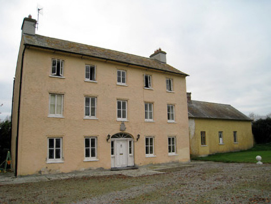 Cooleen Housebridge, country house · 1.1 mi
 Bruree Castle Lower (in ruins)Castle, Anglo-Norman masonry castle · 1.9 mi
 Athlacca Ho. (in ruins)Castle, unclassified · 2.4 mi
 Saint Derivla's WellSpring · 4.4 mi
 European ashEuropean ash · 4.5 mi
 KnockfeerinaMountain / peak · 4.6 mi
 Our Lady's WellSpring · 5.0 mi
 Famine stoneMemorial · 5.2 mi
 Monasteranenagh AbbeyHeritage attraction · 5.2 mi