What is recorded here
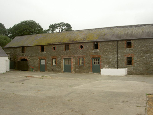
Ranges of stone outbuildings, dated 1800, to Killycroney House. Seven-bay two-storey north range , six-bay single-storey L-plan west range. Pitched slate roofs, clay ridge tiles, uPVC gutters. Random coursed stone walling to north range, painted stone walling to west. Square-headed window openings, red brick surrounds, painted timber casement windows, segmental-headed openings to first floor north range, red brick surrounds, painted timber vertically-sheeted shutters. Square-headed door openings, some red brick surrounds, some doors to north range. Segmental-headed carriage arch and oculus to north range. Part of north range converted to living space. Steps to first floor west elevation north range. Date stone "1800" to south-west corner. Modern farm buildings to north. Ruined granary to south-west of yard. Yard located to east of house.
This official record and map point do not grant access. Most recorded buildings are privately owned; view them only from public ground unless the owner allows entry.