What is recorded here
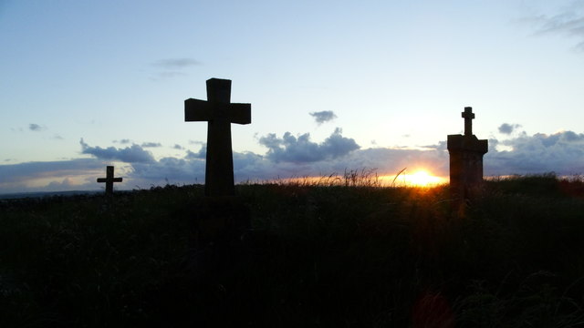
Killaspugbrone Graveyard holds a medieval church at its centre, rising like a island above the surrounding sand dunes. The oval plot stretches seventy metres north to south, bounded by a modern stone wall that keeps the shifting coastline at bay. Gravestones from the 18th through 20th centuries scatter across the sloping ground, marking three centuries of burial beside the bay. The church remains the highest point, a deliberate placement that suggests people wanted the dead near something permanent while the sea rewrote the landscape around them.
In sand dunes a short distance above the S side of Sligo Bay. Oval-shaped area (int. dims. 57m E-W; 70m N-S) enclosed by a modern stone wall. The internal ground level rises from the perimeter to the centre where there is a medieval church (SL013-002001-). The graveyard contains gravestones bearing 18th, 19th and 20th century gravestones.
Compiled by: Patrick F. O'Donovan
Date of upload: 19 January 2011
The monument record does not grant public access. Check the route and ask the landowner before entering private land.
- What survives
- Recorded monument
Places near here
 Killaspugbrone GraveyardRuins · 17 yd
 Killaspugbrone ChurchRuins · 31 yd
 Maguins IslandIslet · 548 yd
 Doonagleragh Lodgehouse · 935 yd
 SuperHeritage attraction · 1511 yd
 CannonMonument · 1593 yd
 Strandhill BeachBeach / strand · 1693 yd
 Doonanpatrick IslandIslet · 1704 yd
 Enclosure in Inishmulclohy OR Coney IslandEnclosure · 1749 yd
 CulleenamoreBeach / strand · 1.8 mi
 Waiting on ShoreMemorial · 2.1 mi
 Rosses Point BeachBeach / strand · 2.1 mi
Other information
Photo: Colin Park · Creative Commons Attribution-ShareAlike 2.0