
What is recorded here
Killamery was a real town in the medieval county of Kilkenny, and its castle still stands as a broad earthen mound at the eastern edge of the village. The Earls Marshall gave the place to the Tobins, or De St. Albin’s, around the beginning of the 13th century, turning a local settlement into a feudal centre. Trees and scrub now choke the mound, but large stones still poke through the south-eastern slope, hinting that the castle was more than a bare heap of soil.
At the eastern end of the modern village of Killamery and c. 100m NNE of the medieval church (KK030-008001-) and graveyard (KK030-008010-). The ground dips at the base of the motte from S-SE before rising gradually to the S. There are good views to the N and W, the land rises to the E and S. Empey (1990, 85) lists Killamery as a town in his map of the medieval county of Kilkenny. The presence of a motte suggests that at the very least it was a manorial centre (KK030-008----). According to Carrigan (1905, vol. 4, 317), ‘the townland of Killamery having been acquired by the Earls Marshall, about the beginning of the 13th century, was granted by them, as a feudal tenancy, to the Tobins, or De St. Albin’s, Lords of Kaemshinagh. This roughly circular earthen motte (basal diam. c. 29m N-S; c. 28m E-W; top diam. c. 18.5m; H 4.5m at SE) is heavily overgrown with trees and scrub. There are some large stones protruding from the mound in the SE quadrant.
Compiled by: Jean Farrelly
Date of upload: 26 July 2017
The monument record does not grant public access. Check the route and ask the landowner before entering private land.
- What survives
- Recorded monument
Places near here
 KillameryVisitor information · 63 yd
 Killamery High CrossVisitor information · 119 yd
 Stone CrossCross, High cross · 131 yd
 Bullaun stone in KillameryBullaun stone · 133 yd
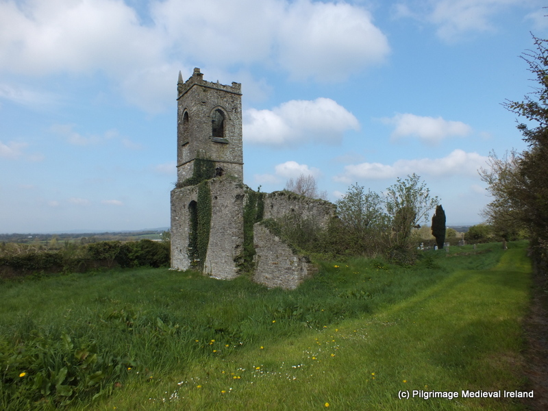 Church (in ruins)Church · 153 yd
 Saint Nicholas's Church (Killamery)church/chapel · 161 yd
 Bawn in GarryrickinBawn · 1.1 mi
 The SpoutMemorial · 1.5 mi
 Castle (in ruins)Castle, unclassified · 1.5 mi
 James (Jim) McKennaMemorial · 1.6 mi
 HawthornHawthorn · 3.1 mi
 European ashEuropean ash · 3.7 mi
Other information
Photo: Credit not shown in the picture search · Rights wording not checked; contact us if this picture should be removed