What is recorded here
Kilbrickan Church stands in a low-lying area of County Laois, its thick rough walls holding two shadowed recesses where windows once caught light. Roberts removed a large inscribed monument from the south wall and reused it as a hearth stone in his bedroom at Kilbrickan House, turning sacred memory into domestic warmth. The graveyard itself has vanished beneath the earth, leaving only the church and that strange second life of its stones.
In a low lying area. No graveyard area is indicated on current edition of the OS 6-inch map. No grave-markers visible.
Described by Carrigan ((Carrigan 1905, vol. 2, 176) as a 'church (LA017-012001-) has all the appearances of great antiquity. It is rectangular in shape and measures 55 and a half feet in length and 26 ft. in breadth, the walls being 3 ft. 9 in. thick and varying in height, at present from 7 ft. downwards. In the south side-wall on the inside, there are two recesses about 2 ft. wide and reaching to the ground, one beside the altar, the other about the middle of the wall; the upper parts of the recesses, probably containing windows, are broken away. There was no doorway in this wall. An aged tree, growing up in the centre of the west gable, probably occupies the place of the original entrance. The stones used in the building were very rough, but not very large, no cut stone. No interments have taken place about the church in the memory of anyone now living. There are no monuments now visible, all having sunk beneath the surface of the graveyard long ago. It is said, however that one large monument (LA017-012003-), with an inscription was formerly fixed into the south wall of the church, on the inside and that it was removed thence to Kilbrickan House by a man named Roberts, who made use of it there as a hearth stone in his bed-room' (Carrigan 1905, vol. 2, 176).
The above description is derived from the published 'Archaeological Inventory of County Laois' (Dublin Stationery Office, 1995) compiled by P. David Sweetman, Olive Alcock and Bernie Moran. In certain instances the entries have been revised and updated in the light of recent research.
Date of upload: 17 December 2007
The monument record does not grant public access. Check the route and ask the landowner before entering private land.
- What survives
- Recorded monument
Places near here
 Church (in Ruins)Church · 16 yd
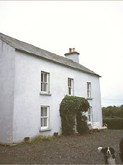 Kilbricken Househouse · 172 yd
 Enclosure in Clonard OR CappaloughlinEnclosure · 1.4 mi
 IndicatedEnclosure · 1.4 mi
 Killeany Castle (ruins)Castle · 1.6 mi
 Site of CastleCastle, unclassified · 2.0 mi
 Sweet ChestnutSweet Chestnut · 2.3 mi
 SycamoreSycamore · 4.0 mi
 Abbeyleix Heritage CentreMuseum · 5.4 mi
 Knocknamoe HouseMemorial · 5.6 mi
 BaunreaghcongMountain / peak · 8.9 mi
 ArderinMountain / peak · 10.0 mi