What is recorded here
The official Northern Ireland record identifies this as INAUGURATION STONE: ST. COLUMB'S STONE. Recorded period: UNCERTAIN. Recorded protection: Scheduled. The official map point was placed at the centre of the recorded archaeological site from the source map reference.
The monument record does not grant public access. Check the route and ask the landowner before entering private land.
- What survives
- Recorded monument
Places near here
 A.P. SITEA.P. SITE, oval enclosure · 1174 yd
 Siege of Derry Boom Stone"The Boom Stone" (Traditionally part of 17th century boom across the River Foyle during the Siege of Derry) · 1247 yd
 BrookhallCountry House · 1.1 mi
 St. Columb's Park HouseHotel · 1.1 mi
 CHURCH, GRAVEYARD & possible ENCLOSURE (from APs): DERGBRUAGH in GranshaCHURCH, GRAVEYARD & possible ENCLOSURE (from APs): DERGBRUAGH · 1.3 mi
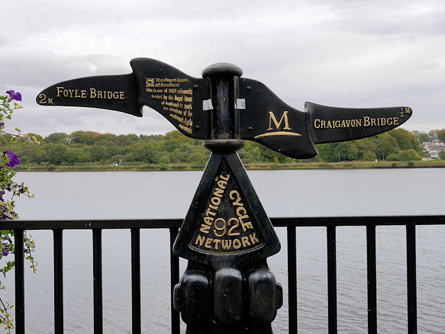 Millennium MilepostVisitor information · 1.4 mi
 Tower MuseumMuseum · 1.5 mi
 TOWER-HOUSE: O'DOHERTY'S CASTLE or THE MAGAZINE in Derry; LondonderryTOWER-HOUSE: O'DOHERTY'S CASTLE or THE MAGAZINE · 1.5 mi
 Battle of the BogsideMajor battlefield · 1.6 mi
 Museum of Free DerryMuseum · 1.6 mi
 Bloody Sunday MemorialMemorial · 1.6 mi
 H-Block MemorialMemorial · 1.7 mi