What is recorded here
Indicated is a fairy fort in Drumsna, County Leitrim, where a roofless Presbyterian meeting house still stands inside the earthen ring. The entrance faces the village fair green, and headstones for the Whitelaw and Parke families mark the quiet ground within. The fort has watched local life for centuries, holding both human memory and older mystery in the same circle.
Located on a gentle W-facing slope within the village of Drumsna. A circular enclosure is depicted on the 1835 edition of the OS 6-inch map with the ruins of a Presbyterian Meeting house in the interior. The rath is a circular area (int. diam. 39m NW-SE) defined by an overgrown earthen bank (Wth 3.3m; int. H 0.25m; ext. H 0.75m) with an external V-shaped fosse (Wth of top 2.1m; ext. D 0.3m). There is an entrance (Wth 2.5m) and causeway at NNW which leads to the Fair Green of Drumsna village. The rath is bisected by a N-S field wall, and the ruins of the meeting house are in the interior. This is a roofless structure (int. dims 15.6m NW-SE; 6.2m NE-SW) with walls almost complete (Wth 0.75m; H 3-5m) and a single doorway in the NW gable. It has headstones of the Whitelaw and Parke families dating from 1819, and the African explorer, Surgeon General Thomas Heazle Parke (1857-93), is also buried here. Archaeological testing (01E0069) immediately to the NW (Read 2003) and testing (02E1235) to the SE (Halpin 2004) produced no related material.
The above description is derived from 'The Archaeological Inventory of County Leitrim' compiled by Michael J. Moore (Dublin: Stationery Office, 2003). In certain instances the entries have been revised and updated in the light of recent research.
Compiled by: Michael Moore
Date of revised upload: 17 October 2019
The monument record does not grant public access. Check the route and ask the landowner before entering private land.
- What survives
- Recorded monument
Places near here
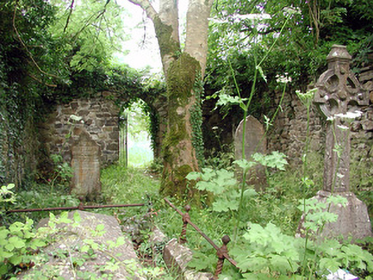 graveyard/cemeterygraveyard/cemetery · 6 yd
 Robert Strawbridge MemorialMemorial · 52 yd
 Catholic Church of the Immaculate Conceptionchurch/chapel · 110 yd
 Patrick Gill Memorial Plaque (IRA)Monument · 165 yd
 IndicatedEnclosure · 418 yd
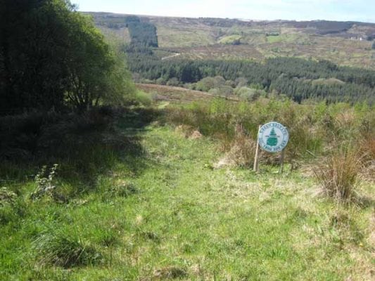 Embanked enclosureFairy fort / earthen ringfort · 485 yd
 Wildlife AreaNature reserve · 575 yd
 Site of Dangan CastleCastle, unclassified · 2.5 mi
 Moon RiverHeritage attraction · 3.7 mi
 InishmoylinIslet · 4.0 mi
 Coarse IslandForest · 4.2 mi
 Dockery's IslandIslet · 4.4 mi