What is recorded here
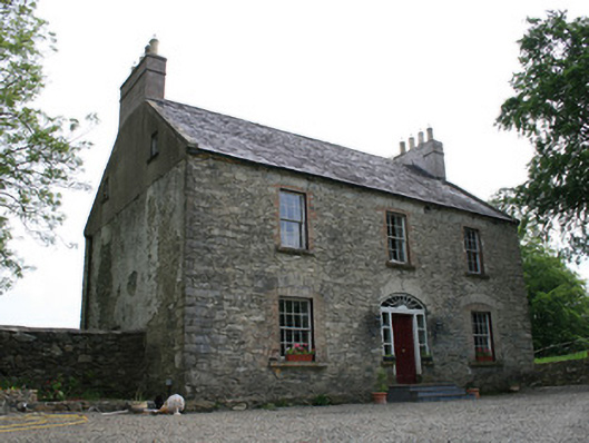
Detached three-bay two-storey house with attic, built c.1800, with single-storey lean-to addition to rear and to west gable, and farm buildings to rear (north). Pitched slate roof, with rendered chimneystacks having decorative string courses to gable ends, and cast-iron rainwater goods. Recent roof-lights to north. Exposed coursed rubble limestone walls, with squared stone quoins. Square-headed window openings with red brick block-and start surrounds, segmental-headed relieving arches with rubble stones voussoirs to window and door openings possibly indicating shape of original openings. Six-over-six pane timber sliding sash windows to long elevations, with some replacement timber casement windows to rear. Segmental-headed door opening with replacement segmental-headed doorcase of timber-framed fanlight and sidelights flanking raised-and-fielded timber panelled door, approached by replacement stone platform, and three recent stone steps. Range of single and two-storey stable and farm buildings forming courtyard, with pitched slated roofs and coursed rubble limestone walls, segmental-headed openings with gauged-brick surrounds to doors and windows. Main approach from south-west with wrought-iron gates on cut-stone square-plan piers with domed stone caps. Located on hill, north of Ballybay to Newbliss road in close proximity to Derryvally Presbyterian complex to west and Craig’s Castle to south-east.
Add the human story, a picture, a first-hand message or a missing place.
Earn 5 points after the picture is checked and accepted.
Add a pictureAdd its storyTalk or ask a questionAdd a new placeThis official record and map point do not grant access. Most recorded buildings are privately owned; view them only from public ground unless the owner allows entry.
Conversation about this place
Questions and messages sit beneath the source record. They are checked before appearing.
No questions or messages yet.
Ask a question or join the conversation