What is recorded here
About 10 years ago when the Glencolumbkille Folk Village was being built this cross-slab was found. It had originally come from somewhere within a 20 mile radius and had been recently broken. It is .84m × 0.2m to .52m × 0.075m. A thinly incised double-banded cross, interlaced at the centre and with triquetra terminals can be seen on it. It is behind the cottage called 'An Longphort'.
The above description was derived from the 'Archaeological Survey of County Donegal. A description of the field antiquities of the County from the Mesolithic Period to the 17th century.' Compiled by: Brian Lacey with Eamon Cody, Claire Cotter, Judy Cuppage, Noel Dunne, Vincent Hurley, Celie O'Rahilly, Paul Walsh and Seán Ó Nualláin (Lifford: Donegal County Council, 1983). In certain instances the entries have been revised and updated.
Date of upload: 22 September 2008
This cross-slab likely dates to the early medieval period, possibly between the 8th and 11th centuries, and may have originally served as a Christian memorial or waymark. Its relocation and recent breakage suggest it was repurposed or moved in more recent historical contexts.
The monument record does not grant public access. Check the route and ask the landowner before entering private land.
- What survives
- Recorded monument
Places near here
 St. Faneds CellHermitage · 26 yd
 IndicatedHoly well · 98 yd
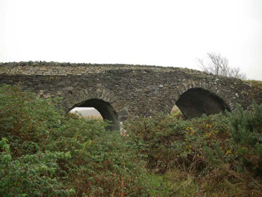 Droichead an tSráidbridge · 497 yd
 Glencolmcille Folk VillageMuseum · 499 yd
 Trá an GhleannaBeach / strand · 521 yd
 Teach Pobail Naomh Columbachurch/chapel · 529 yd
 An Trá Bheag (Trá Bheag an Ghleanna)Beach / strand · 782 yd
 Glencolmcille Old GraveyardGraveyard · 919 yd
 Rossan PointHeadland · 2.5 mi
 Silver Strand ViewpointViewpoint · 3.4 mi
 Slieve LeagueMountain / peak · 3.9 mi
 Slieve League SE TopMountain / peak · 4.3 mi