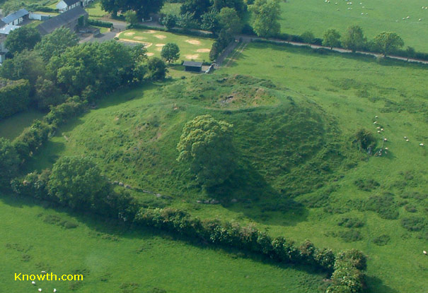
What is recorded here
Located on a bluff overlooking a NW-SE section of the River Boyne, which is c. 100m to the SW. This monument was first identified from a LiDAR Survey of the Brú na Bóinne World Heritage Site (Davis et al. 2013), and was confirmed by a magnetic gradiometry survey (12R0080) conducted during 2012. Close analysis of these results identifies three widely-spaced ditch features (ext. dims c. 123m E-W; c. 104m N-S). The innermost enclosure (diam. c. 60m) has at least one possible Man-made underground passage identified as a trench in the NW interior, while a rectangular house site is identifiable in the NE interior. Two other house-sites are in the vicinity and a line of at least three rectangular fields (dims c. 40m x c. 30m) extend NNW from the innermost ditch feature. (Ní Lionáin and Davis 2016, 134-5)
Two cores were extracted (16E0347) by Clíodhna Ní Lionáin and other from the inner (Wth of top 8-9m; min. D 1.5m) and middle (Wth of top 6-7m; min. D 2.68m) ditches of this monument (excavation.ie 2016:848) for chemical analysis. The higher phosphate values of the inner fosse suggest that it has accumulated more settlement debris.
Compiled by Michael Moore
Date of revised upload: 9 December, 2016
Amended: 3 February 2021
Add the human story, a picture, a first-hand message or a missing place.
Earn 5 points after the picture is checked and accepted.
Add a pictureAdd its storyTalk or ask a questionAdd a new placeThe monument record does not grant public access. Check the route and ask the landowner before entering private land.
Conversation about this place
Questions and messages sit beneath the source record. They are checked before appearing.
No questions or messages yet.
Ask a question or join the conversation