Add the human story, a picture, a first-hand message or a missing place.
Earn 5 points after the picture is checked and accepted.
Add a pictureAdd its storyTalk or ask a questionAdd a new placeWhat is recorded here
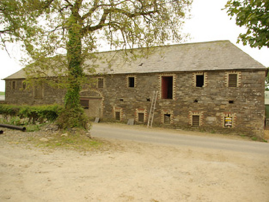
Detached eleven-bay two-storey outbuilding, built c. 1869, having blocked integral carriage-arch to the centre of the main elevation (north-west). Probably originally associated with two-storey house adjacent to the south-west. Possibly formerly associated with flax and\or corn mills to the south-east (Ordnance Survey first and third edition six-inch maps of 1836 and c. 1902). Hipped natural slate roof having cut stone eaves course, and with some remaining sections of cast-iron rainwater goods. Randomly coursed rubble stone walls with flush bush-hammered limestone quoins to the corners. Square-headed window openings having decorative red and yellow block-and-start surrounds and voussoirs, and timber louvered vents. Square-headed door openings at ground floor level and loading bays at first storey level having decorative red and yellow block-and-start surrounds and voussoirs, and some remaining battened timber doors. Some openings now blocked. Segmental-headed carriage-arch, now infilled with modern blockwork, having decorative red and yellow block-and-start surrounds and voussoirs, and with cut stone keystone over incised ‘1869’ and ‘R.W.’. Remnant machinery evident in adjoining yard, two sandstone mill stones form entrance to neighbouring property. Located to the north-east of Stranorlar, and adjacent to the north-west of two-storey house and associated complex of outbuildings.
This official record and map point do not grant access. Most recorded buildings are privately owned; view them only from public ground unless the owner allows entry.
Conversation about this place
Questions and messages sit beneath the source record. They are checked before appearing.
No questions or messages yet.
Ask a question or join the conversation