
What is recorded here
Lisnabrocka is a ruined ringfort on a Galway hill, its stone wall collapsed into grass and its boundary marked only by a shallow scarp. The main circle measures barely twenty-four metres across, with a smaller annexe clinging to the east side like a forgotten room. Field walls fade westward into the land, suggesting people once lived here before the stones sank back into the earth.
On a hill summit in undulating grassland. This poorly preserved cashel consists of an almost circular area (NW-SE c. 24.2m, NE-SW c. 23.5m) defined by a collapsed grassed-over drystone wall from E through S to N, and by a scarp from N to E. An irregularly shaped annexe (c. 13m by c. 9m), defined by a grass-covered collapsed stone wall, abuts the cashel wall at E. Traces of old field walls are visible to W.
The above description is derived from the published 'Archaeological Inventory of County Galway Vol. II - North Galway'. Compiled by Olive Alcock, Kathy de hÓra and Paul Gosling (Dublin: Stationery Office, 1999).
Date of upload: 05 August 2010
The monument record does not grant public access. Check the route and ask the landowner before entering private land.
- What survives
- Recorded monument
Places near here
 Enclosure in Carrowbeg (clare By.)Enclosure · 60 yd
 Toberkeeraun Holy WellHoly well · 190 yd
 Kildaree Church (in ruins)Church · 391 yd
 Church in ruinsChurch · 1193 yd
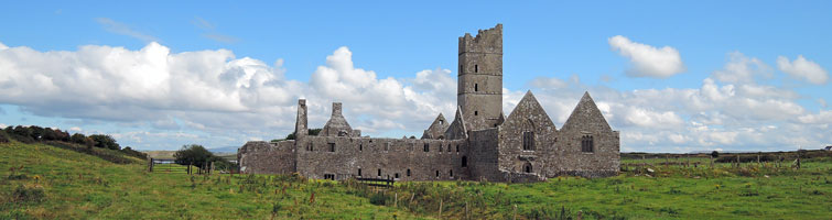
 Ross Errilly FriaryHeritage attraction · 1.2 mi
 BallynacreggaWood · 1.7 mi
 Tower; Proposed site of Ross AbbeyCastle, unclassified · 1.7 mi
 Headford CastleCastle, unclassified · 1.9 mi
 Walsh's IslandIslet · 3.3 mi
 Freeheen IslandIslet · 3.4 mi
 Kilcoona Round TowerHeritage attraction · 4.8 mi
 Ballinduff BayBay · 5.1 mi
Other information
Photo: Credit not shown in the picture search · Rights wording not checked; contact us if this picture should be removed