What is recorded here
Half a dozen paces from the Owennagearagh River, a broken earthen ring still marks the field where people lived before ploughs erased its southern edge. The surviving bank rises barely higher than a knee, yet it holds the shape of a home large enough for animals, hearths and argument. Fairy fort is the name locals gave what they did not understand; a ringfort is what the earth remembers.
In pasture, short distance NE of Owennagearagh River. Hachured as circular enclosure (diam. c. 55m) on 1842 OS 6-inch map; SE half levelled on 1904 and 1937 OS 6-inch maps. Arc formed by earthen bank (int. H 0.6m; ext. H 1.3m) survives to NW and N. Remains of cultivation ridges cross interior and surrounding field. Enclosure to W and N skirted by field boundary.
The above description is derived from the published 'Archaeological Inventory of County Cork. Volume 3: Mid Cork' (Dublin: Stationery Office, 1997). In certain instances the entries have been revised and updated in the light of recent research.
Date of upload/revision: 14 January 2009
The monument record does not grant public access. Check the route and ask the landowner before entering private land.
- What survives
- Recorded monument
Places near here
 Mass-rock in Ballyshoneen (muskerry East By., Inishcarra Par.)Mass-rock · 396 yd
 IndicatedKiln, lime · 580 yd
 Man-made underground passage in BerringsMan-made underground passage · 1470 yd
 Ballyanly Inniscarra Slí na SláinteWalking route · 1501 yd
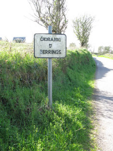 sign postsign post · 1701 yd
 Bob AdamsMemorial · 2.4 mi
 Castle Inch (in Ruins)Castle, tower house · 2.8 mi
 Ballyvodane Castle (in Ruins)Castle, unclassified · 2.8 mi
 Iniscarra Dam ViewViewpoint · 3.1 mi
 Hugh MaguireMemorial · 3.6 mi
 Coachford Greenway (End)Visitor information · 4.2 mi
 Blarney lake bird nest islandIslet · 4.3 mi