What is recorded here
No outcrop or painted stone remains visible in the level pasture, though a large weathered rock now blocks a collapsed boundary wall nearby. The hidden surface may still hold marks beneath dirt and shadow, waiting for rain or patience to reveal them. The valley, mountains and river gap remain unchanged, preserving the shape of the place even when its art disappears from sight.
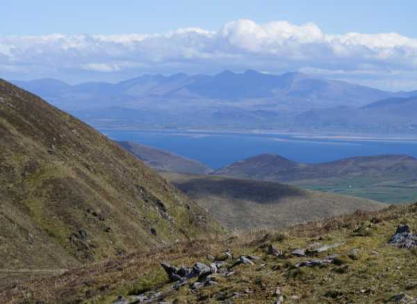
In generally level pasture (103m OD), overlooking valley to W. Good views of surrounding landscape and enclosed by higher ground all around. Beenoskee and Stradbally mountain clearly visible to N and gap in mountains to S, where Owenascaul River enters the sea. No visible surface trace. No outcrop visible anywhere in this half of field. A large rock has been used to block an opening in a collapsed drystone boundary, adjacent to NW. Stone is weathered and only parts of surface were visible; no markings evident, although these could be obscured by its current location.
Compiled by: Alison McQueen and Vera Rahilly
Date of upload: 7 July 2017
Likely dating to the Neolithic or Bronze Age, this rock art may have held ritual or territorial significance, possibly linked to landscape orientation or celestial markers. No specific folklore is recorded for the site.
The monument record does not grant public access. Check the route and ask the landowner before entering private land.
- What survives
- Recorded monument
Places near here
 Fairy fort / stone ringfort in An Gabhlán ArdFairy fort / stone ringfort · 346 yd
 Hut site in An Gabhlán ArdHut site · 408 yd
 Séipéal Eoin Baiste [Catholic Church of Saint John the Baptist]church/chapel · 1325 yd
 Lispole Viaductbridge · 1330 yd
 Lispole Ambush MonumentWayside cross · 1394 yd
 An Cnapán MórMountain / peak · 1.6 mi
 Cruach SceirdeMountain / peak · 1.6 mi
 Caisleán na Mine AirdeCastle · 2.4 mi
 Minard Castle (in ruins)Castle, tower house · 2.4 mi
 Tobar EoinSpring · 2.5 mi
 CarrigavinnaunNamed rock · 2.7 mi
 Maughanablagher CliffsCliff · 2.8 mi