
What is recorded here
Marianne and I walked into Rathmarree at dusk, its earth bank rising like a sleeping beast. She touched the grass and laughed, saying the fort was warm because it remembered every person who ever circled it. We walked twice around the inside, not once, and the path felt familiar although we had never visited. When we left, her hand still tingled, as if the fort had taken a small piece of her heat and kept it for the winter.
The Archaeological Survey of Ireland (ASI) is in the process of providing information on all monuments on The Historic Environment Viewer (HEV). Currently the information for this record has not been uploaded. To access available information for research purposes please make an appointment in advance with the Archive Unit (open Fridays 10.00 am – 5.00 pm), Department of Housing, Local Government and Heritage, The Custom House, Dublin 1 D01W6XO or email NMarchive@housing.gov.ie.
Rathmarree, Derrynacarragh is a ringfort, typically dating to the early medieval period (c. 500–1000 AD), and is likely associated with early Irish farming or settlement communities. Local folklore may connect it with fairy traditions, as many such forts were believed to be the homes of the "good people" in Irish legend.
The monument record does not grant public access. Check the route and ask the landowner before entering private land.
- What survives
- Recorded monument
Places near here
 Gortraheen FortFairy fort / earthen ringfort · 888 yd
 Enclosure in BallyillaunEnclosure · 1184 yd
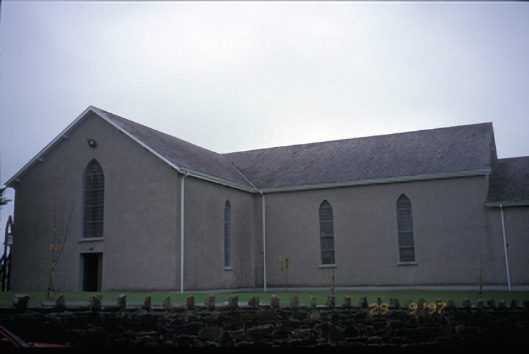 Catholic Church of Saint John the Baptistchurch/chapel · 1.4 mi
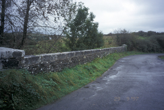 Drumanure Bridgebridge · 1.6 mi
 Shallee Castle (in Ruins)Castle, tower house · 3.6 mi
 Poul na gollorCave · 4.0 mi
 Inch Castle (in Ruins)Castle, tower house · 4.0 mi
 European ashEuropean ash · 5.0 mi
 Alice and Gwendoline CaveMuseum · 5.3 mi
 Rockmount WoodWood · 5.5 mi
 Killone AbbeyHeritage attraction · 5.7 mi
 SlievecallanMountain / peak · 5.8 mi
Other information
Photo: Credit not shown in the picture search · Rights wording not checked; contact us if this picture should be removed