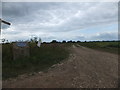
What is recorded here
This blue commemorative plaque records: RAF Selsey 1943-1945 From these fields Spitfires & Typhoons provided cover for the Allied invasion forces on D-Day 1944 English, Belgian, French & New Zealand squadrons were based here Recorded plaque organisation: West Sussex County Council.
RAF Selsey was a critical Royal Air Force station during World War II, serving as a base for Spitfire and Typhoon squadrons that provided essential air cover for Allied forces during the D-Day invasion in 1944.
A plaque record does not grant entry to a building or private land. View it from a public place unless permission is clearly given.
Places near here
 Norton PrioryListed building · 617 yd
 Church Norton MoundArchaeological place · 762 yd
_sculpture,_Selsey_-_geograph.org.uk_-_3527695.jpg?width=1280) The Wave (or Kanagawa) sculpture, SelseyPublic sculpture · 1286 yd
The Wave (or Kanagawa) sculpture, SelseyPublic sculpture · 1286 yd Eric CoatesMemorial · 1591 yd
 Northcommon Farm CottagesListed building · 1701 yd
 RSPB Pagham Harbour Visitor CentreVisitor information · 1727 yd
 Selsey BillHeadland · 2.1 mi
 Florence PondVisitor information · 2.4 mi
 Hoare monument, SidleshamMonument or public art · 2.4 mi
 Medmerry BeachBeach / strand · 2.6 mi
 The Pound HouseMemorial · 3.5 mi
 Statue outside St Richard, AldwickMonument or public art · 3.6 mi
Other information
Photo: David Smith on Geograph · CC BY-SA 2.0