
What is recorded here
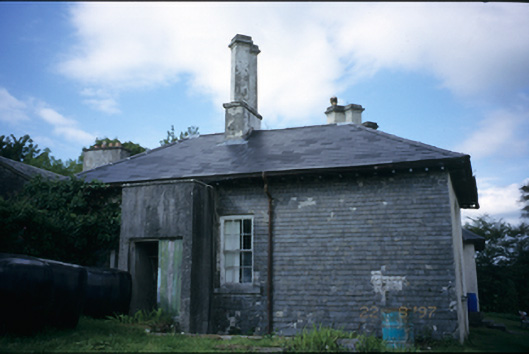
Situated on the S side of the road in lowlying undulating countryside. The remains of a church, erected at the end of the 18th century as a mass-house and later used as the Roman Catholic parish church until St. Mary’s church was built at nearby Roxton in 1869 (Swinfen 1992, 93). The church (ext. dims. 20.1m E-W; 6.35m N-S; remaining wall H 1-2.5m; T 0.6m) is least well preserved at N but towards the E on that wall there is a gap (Wth 1.2m) which must have been a doorway as there is a stoup in the wall to the W. No other doors or windows are discernible. The church had good quoins (0.8m x 0.4m x 0.3m) at the corners, laid in alternate directions.
Compiled by: Mary Tunney
Date of upload: 11 July 2016
The monument record does not grant public access. Check the route and ask the landowner before entering private land.
- What survives
- Recorded monument
Places near here
 Enclosure in CurraghkeelEnclosure · 263 yd
 LiscullaunEnclosure · 368 yd
 Castle (in Ruins)Castle, tower house · 598 yd
 Saint Mary's Catholic Churchchurch/chapel · 1110 yd
 Bawn in CregmoherBawn · 1576 yd
 Adelphihouse · 1.1 mi
 Rock IslandIsland · 1.4 mi
 Inchiquin IslandIslet · 1.4 mi
 Battle of TullyodeaBattlefield · 3.1 mi
 Fergus River CaveCave · 3.3 mi
 European ashEuropean ash · 3.5 mi
 Ballygriffy WoodWood · 3.9 mi
Other information
Photo: Credit not shown in the picture search · Rights wording not checked; contact us if this picture should be removed