What is recorded here
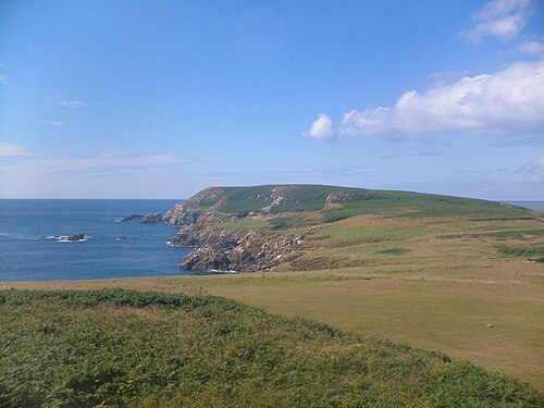
The headland marked on the OS discovery map for the site of a promontory fort (upper picture) shows no sign of having been defended. A low rocky promontory on the southern tip of Little Saltee has an earthen bank or collapsed and grassed-over stone wall crossing it (lower picture [WX051B004----]). Not yet visited. The possible fort [WX051A002001] on the Great Saltee is not marked on the discovery map and possibly the islands were mixed up by the OS. (Casey 2001)
The monument record does not grant public access. Check the route and ask the landowner before entering private land.
- What survives
- Recorded monument
Places near here
 Little SalteeIslet · 514 yd
 Enclosure in Saltee Island GreatEnclosure · 1729 yd
 Not idnicatedStructure · 1.0 mi
 follyfolly · 1.4 mi
 obeliskobelisk · 1.4 mi
 Great SalteeIsland · 1.6 mi
 Kilmore Quay Walking TrailVisitor information · 2.6 mi
 Whale boneHeritage attraction · 2.7 mi
 Kilmore Quay - Crehen Twinning MemorialMemorial · 2.7 mi
 Memorial Trail & Garden in Honour of Those Lost at SeaMemorial · 2.7 mi
 Ballyhealy BeachBeach / strand · 4.7 mi
 Castle (in ruins)Castle, tower house · 4.8 mi