What is recorded here
Sniper: yes. That is an invitation to use the example, not a warning. I should have written the example.
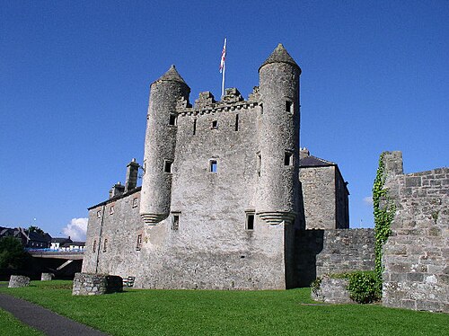
The official Northern Ireland record identifies this as PLANTATION HOUSE & BAWN. Recorded period: POST-MED; C17TH. The official map point was placed at the centre of the recorded archaeological site from the source map reference.
Built during the 17th century as part of the Ulster Plantation, Plantation House & Bawn in Cornagrade was likely constructed by English or Scottish settlers under royal commission. It is remembered as a symbol of colonial settlement and the transformation of land ownership in post-medieval Northern Ireland.
The monument record does not grant public access. Check the route and ask the landowner before entering private land.
- What survives
- Recorded monument
Places near here
 Devenish Local Nature ReserveNature reserve · 533 yd
 Cherry IslandIsland · 542 yd
 Railway MuseumMuseum · 701 yd
 The Inniskillings MuseumMuseum · 715 yd
 Methodist ChurchChurch · 720 yd
 Methodist Church HallHall · 730 yd
 Boer War MemorialMemorial · 733 yd
 ENNISKILLEN CASTLE in EnniskillenENNISKILLEN CASTLE · 744 yd
 C18TH CHURCH with C17th TOWER, & GRAVEYARD: ENNISKILLEN CHURCH in EnniskillenC18TH CHURCH with C17th TOWER, & GRAVEYARD: ENNISKILLEN CHURCH · 748 yd
 Castle IslandIslet · 961 yd
 Siege of Enniskillensiege · 1098 yd
 Cole's MonumentMonument · 1131 yd