What is recorded here
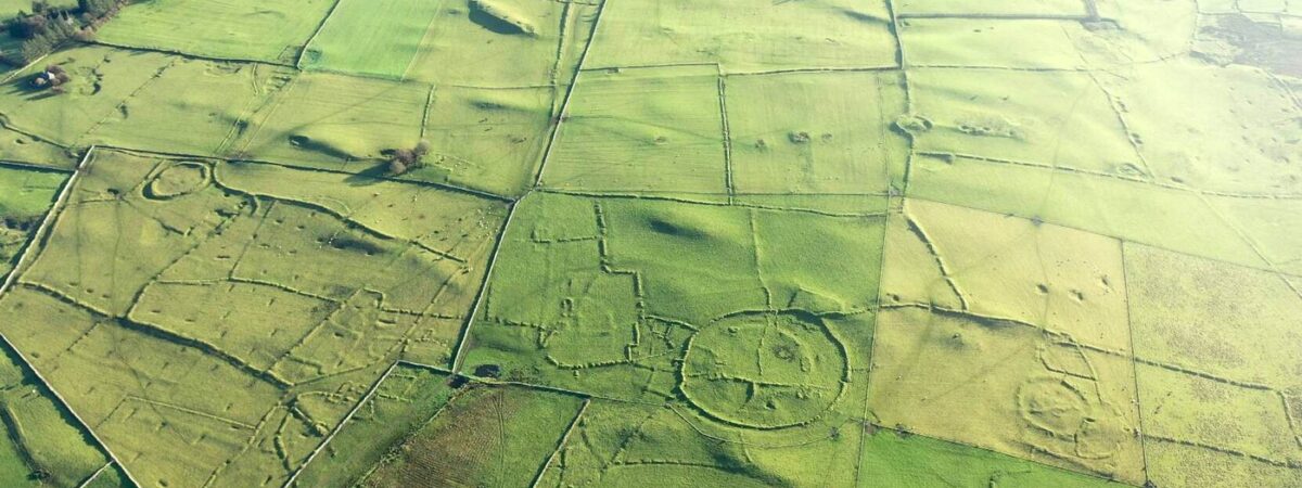
On a low E-W ridge on the floor of a NW-SE valley at the bottom of the S-facing slope of Rathcroghan ridge. Rectangular grass-covered pits (dims c. 5-10m x c. 2-3m; D c. 0.6m) survive amongst the field banks of field system (RO022-057044-) covering an area of c. 12 ha (c. 30 acres). They are generally aligned E-W and are frequently aligned on the field banks.
See the attached aerial images at the S looking SE (001), and from the NE (019) looking towards Relig na Rí (RO022-057035-).
Compiled by: Michael Moore
Date of upload: 24 August 2010
The monument record does not grant public access. Check the route and ask the landowner before entering private land.
- What survives
- Recorded monument
Places near here
 IndicatedFairy fort / earthen ringfort · 622 yd
 RelignareeConcentric enclosure · 688 yd
 RoadRoad, road/trackway · 1.3 mi
 CastlerubyCastle, unclassified · 1.4 mi
 European ashEuropean ash · 1.4 mi
 ToberagullaSpring · 1.4 mi
 Church in OgullaChurch · 1.4 mi
 Cruachan Aí Heritage CentreMuseum · 2.2 mi
 GortnacushlaunCastle, unclassified · 4.5 mi
 War of Independence Commemorative Military MemorialMemorial · 4.9 mi
 Silver IslandIslet · 6.8 mi
 Workhouse MemorialMemorial · 7.4 mi