What is recorded here
Situated 2.5m from the SE shore of Inis Cealtra, c. 40m S of St. Mary’s church (CL029-009008-) in a rough, marshy area. Named ‘Stone’ in Gothic script on the 1920 OS 6-inch map and listed in the RMP (1996) as 'Potential site - name'. The monument comprises 3 stones. An unworked conglomerate base stone ( Wth 0.74m; L 1m; H 0.22m) aligned NW-SE has a round-bottomed channel (Wth 0.2m; D 0.12m) extending along its long axis. Two limestone slabs are attached on top, overhanging the channel and meeting along its long axis. The larger slab (max. L 0.98m; max. Wth 0.4m; T 0.13m) is at NE. It has a pronounced convex curve on its NE face and a less pronounced concave curve on the SW face. The smaller slab is roughly rectangular (max. L 0.5m; max. Wth 0.28m; T 0.12m). Some of the channel is exposed at each end beneath this slab. There may have been other stones covering each end (Macalister 1916-17, 144). This group of stones is known traditionally as the ‘Bargaining stone’ as people joined hands through the channel to seal a bargain or a promise.
Compiled by: Mary Tunney
Date of upload: 21 October 2015
A penitential station associated with early Christian pilgrimage on Inishcaltra (Inis Cealtra), linked to the holy site of St. Mary’s church; such stations were used by pilgrims undertaking acts of penance as part of their spiritual journey. The island itself is traditionally connected to St. Gobnait and was an important monastic and pilgrimage site in the early medieval period.
The monument record does not grant public access. Check the route and ask the landowner before entering private land.
- What survives
- Recorded monument
Places near here
 Lady WellHoly well · 59 yd
 St. Marys ChurchChurch · 63 yd
 Cross in Inishcaltra OR Holy IslandCross · 125 yd
 Inishcaltra or Holy IslandIslet · 230 yd
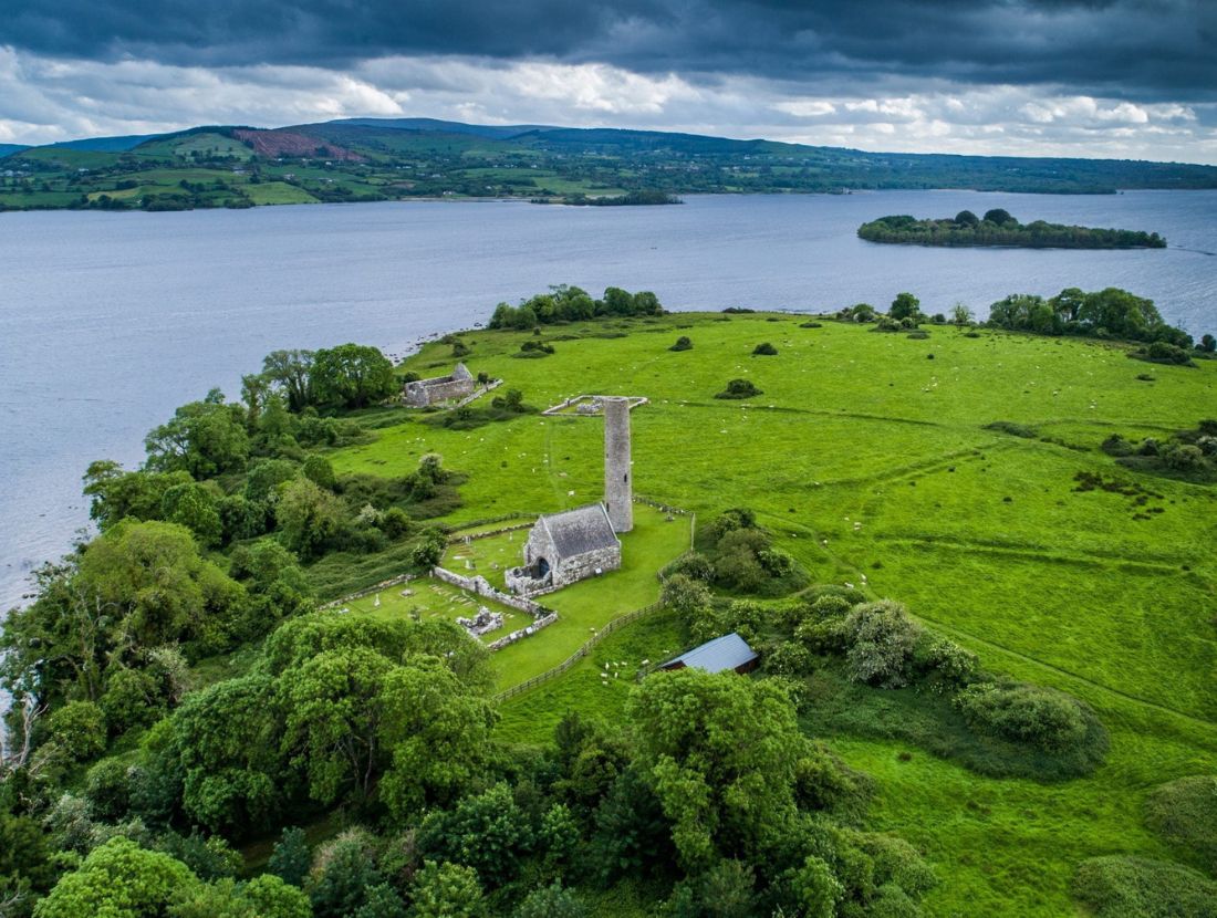 Baptism ChurchChurch · 238 yd
 Pedunculate OakPedunculate Oak · 1666 yd
 The MazeHeritage attraction · 1.4 mi
 Bawn in Caher (tulla Lower By.)Bawn · 1.5 mi
 Scarriff BayBay · 1.5 mi
 Castle BaunCastle · 1.7 mi
 Aughinish WoodForest · 1.7 mi
 Cloonoolia BayBay · 1.9 mi