What is recorded here
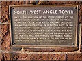
This brown commemorative plaque records: North-west angle tower. This is the position of the stone tower at the north-west corner of the Roman fortress. It was built soon after A.D.103, and was discovered during the construction of St. Martin's Gate in 1965. The tower was 30 feet wide and 27 feet deep, with walls a little over 4 feet thick. It marks the point at which the Roman and Medieval defences diverge. The fortress was here turning southwards towards Holy Trinity Church which is on the site of the Roman west gate (porta principalis dextra).
The North-west Angle Tower was part of the Roman fortress in what is now York, constructed around A.D. 103 to fortify the northwestern corner; its discovery in 1965 provides insight into the layout and defensive architecture of Roman Britain.
A plaque record does not grant entry to a building or private land. View it from a public place unless permission is clearly given.
Places near here
 Morgans MountListed building · 31 yd
 Part of City Wall From Pembertons Parlour to St Martins Gate (not Included)Listed building · 52 yd
 Parish of St Martin Boundary StoneMonument or public art · 210 yd
 The Little Abbey Gateway, Northgate StreetScheduled monument · 273 yd
 A Celebration of Chester, sculpturePublic sculpture · 327 yd
 War MemorialMemorial · 436 yd
 Dewa Roman ExperienceMuseum · 566 yd
 Roman Angle TowerVisitor information · 766 yd
 Roman GardensVisitor information · 942 yd
 Chester CastleCastle · 993 yd
 Roman quarry including Edgar's Cave and the rock-cut figure of Minerva on Edgar's Field, 150m south west of Dee BridgeScheduled monument · 1193 yd
 Thomas Brassey StatueMemorial · 1228 yd
Other information
Photo: John S Turner on Geograph · CC BY-SA 2.0