
What is recorded here
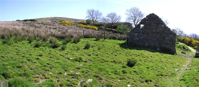
The official Northern Ireland record identifies this as MULTIPERIOD CHURCH & GRAVEYARD (Early Christain-C18th). Recorded period: POST-MED; E.CHRIST.; MED/L.MED. The official map point was placed at the centre of the recorded archaeological site from the source map reference.
A multiperiod church and graveyard dating from the Early Christian period to the 18th century; it reflects continuous religious use and burial practices over a millennium. Its significance lies in its layered history, offering insights into ecclesiastical development and community life in medieval and post-medieval Northern Ireland.
The monument record does not grant public access. Check the route and ask the landowner before entering private land.
- What survives
- Recorded monument
Places near here
 Claudy bombingbomb attack · 833 yd
 ENCLOSURE in Ling; TullintrainENCLOSURE · 1.2 mi
 ENCLOSURE? in Alla UpperENCLOSURE? · 1.4 mi
 Brackfield BawnCastle · 2.5 mi
 CrockdooishMountain / peak · 2.7 mi
 The Ness WoodWood · 3.0 mi
 Learmount WoodWood · 3.7 mi
 Learmount CastleCountry House · 3.7 mi
 Altinaghree CastleCastle · 4.0 mi
 Banagher Presbyterian ChurchChurch · 4.5 mi
 Chambered GraveArchaeological place · 5.0 mi
 SlievekirkMountain / peak · 5.4 mi
Other information
Photo: Kenneth Allen · CC BY-SA 2.0