
What is recorded here
Single-arch bridge over canal, built 1795. Bypassed, 1995. Now in alternative use. Repointed rubble stone walls between part creeper- or ivy-covered repointed rubble stone battered abutment walls with tooled cut-limestone rounded coping to parapets centred on weathered cut-limestone panel (east). Single elliptical or pseudo three-centred arch with repointed drag edged tooled limestone ashlar voussoirs. Sited spanning Royal Canal with flagged towpath to canal.
A bridge identified as an important component of the late eighteenth-century civil engineering heritage of Maynooth on account of the connections with the development of the Royal Canal (opened 1796) with the architectural value of the composition confirmed not only by the deep grey limestone dressings demonstrating good quality workmanship, but also by the elegant "sweep" of the arch making a pleasing visual statement at a crossing over the canal: meanwhile, a much weathered benchmark remains of additional interest for the connections with cartography and the preparation of maps by the Ordnance Survey (established 1824).
This does not grant access. Most recorded buildings are privately owned; view them only from public ground unless the owner allows entry.
Places near here
 canal (section of)canal (section of) · 184 yd
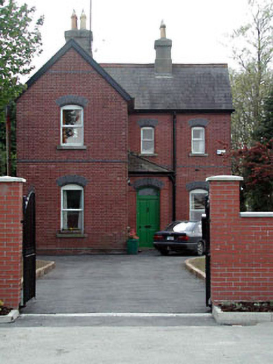 Maynooth Railway Stationstation master's house · 197 yd
 Memorial to 1916 Volunteers from MaynoothMemorial · 335 yd
 Common LimeCommon Lime · 450 yd
 The Tree of Liberty 1798-1998Memorial · 450 yd
 Maynooth CastleHeritage attraction · 515 yd
 CastleCastle, Anglo-Norman masonry castle · 518 yd
 European YewEuropean Yew · 525 yd
 The Sun ClockHeritage attraction · 532 yd
 Enclosure in MaynoothEnclosure · 1189 yd
 IndicatedHoly well · 1424 yd
 Moygaddy CastleCastle, tower house · 1.1 mi
Other information
Photo: MotivatedJellyFish · CC BY-SA 4.0