What is recorded here
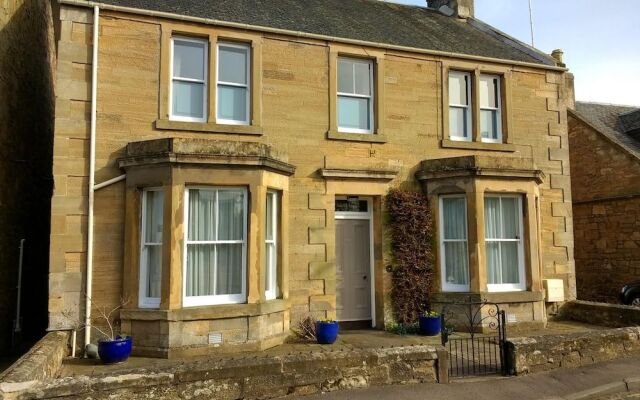
Vacant 3-storey house on NE side of Charleville, adjacent to site of 17th-century Charleville House (14930). Rendered over random-rubble limestone with ashlar quoins. Entrance front (NW) of 3 bays with slightly irregular fenestration, the end bay is part of a bow-ended addition at SW end of house. Central round-headed door ope with pedimented wooden surround, door recessed. Rectangular sash windows (ground-floor windows recently blocked); second floor sash windows have segmental-headed opes. Window opes in added bay at SW end of front elevation are set higher than the other windows, accommodating high-ceilinged rooms within. Addition at SW end has bow-fronted end elevation (SW) with large tripartite sash windows on each floor. Hipped roof over house also covers bow front. Gable-ended to NE with 2-storey kitchen addition, attic window visible. Central segmental-headed window in middle of rear elevation. Chimney atop NE gable, second chimney off-centre to SW. House built on corner of boundary around Charleville House (14930) and may contain part of earlier structure associated with earlier house though there is no evident features in house of that date. Long 1-storey range of farm buildings extends to rear, one accommodating horse stalls. Entrance lodge, photographed in 1984; no longer survives: 1 storey, 3-bay, pointed window opes, steeply pitched corrugated iron roof. Walled garden to NE. Fields to E and S enclosed by substantial stone walls associated with Charleville House (14930).
The above description is derived from the published 'Archaeological Inventory of County Cork. Volume 4: North Cork' (Dublin: Stationery Office, 2000). In certain instances the entries have been revised and updated in the light of recent research.
Date of upload/revision: 14 January 2009
The monument record does not grant public access. Check the route and ask the landowner before entering private land.
- What survives
- Recorded monument
Places near here
 Moatvillehouse · 11 yd
 Country house in Rathgoggan MiddleCountry house · 88 yd
 MoatEnclosure · 100 yd
 Holy Cross CemeteryGraveyard · 1228 yd
 Moanboy FortFairy fort / earthen ringfort · 1644 yd
 Bawn in CregganeBawn · 1.5 mi
 Castle Harrison on Site of Castle (19*Castle, unclassified · 2.6 mi
 ToberSpring · 2.6 mi
 Lady's WellSpring · 2.6 mi
 BallinaboolaVisitor information · 4.2 mi
 Caher HillMountain / peak · 4.8 mi
 CarrigeenMountain / peak · 4.9 mi
Other information
Photo: Credit not shown in the picture search · Rights wording not checked; contact us if this picture should be removed