What is recorded here
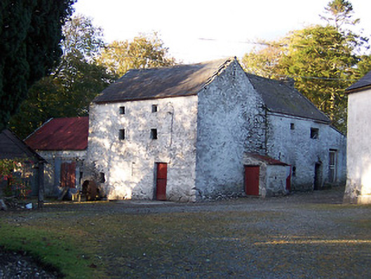
Tuck mill complex on L-shaped plan, built c.1800, comprising a main two-bay three-storey mill building having a three-storey return to the north and a two-storey ancillary structure attached to the west side. Later in use as a corn mill (Ordnance Survey Map 1914), and now out of use. Pitched natural slate roof to main building (south) having projecting eaves course and cast-iron rainwater goods. Pitched corrugated roof to rear return with a projecting eaves course and with a rubble stone chimneystack to north gable. Pitched corrugated metal roof to building attached to the west. Coursed rubble limestone walls with whitewashed lime render over, now failing in places, with square-headed openings having timber sheeted doors and half-doors. Window fittings now gone. Set back from road in own grounds with former mill race running north-to-south to the west side of the complex and with a two-storey former miller’s house/farmhouse (154031336) to the east. Located to the northeast of Horseleap and to the west of Ballinagore.
Add the human story, a picture, a first-hand message or a missing place.
Earn 5 points after the picture is checked and accepted.
Add a pictureAdd its storyTalk or ask a questionAdd a new placeThis official record and map point do not grant access. Most recorded buildings are privately owned; view them only from public ground unless the owner allows entry.
Conversation about this place
Questions and messages sit beneath the source record. They are checked before appearing.
No questions or messages yet.
Ask a question or join the conversation