What is recorded here
Located beneath a public car park, c. 40m to E of Drumcliff round tower (SL008-082004-) and 8m N of the high cross (SL008-084004-) and graveyard (SL008-084002-).
This midden was found in August 2018 during archaeological monitoring (Licence no. E005004) of the digging of a service trench (L 2.5m E−W; Wth 1.15m; D 0.8m) to repair a leaking water pipe (McHugh 2018). The midden was exposed at a depth of 0.5m below the surface in the N section face of the trench. It consisted of a layer (L 1m E−W; D 0.2m) of oyster, periwinkle and limpet shells in a matrix of dark-brown, friable clayey silt. The midden was recorded, and is preserved in situ. The trench was backfilled with gravel. (McHugh 2018, 31-34).
Compiled by: Jane O’Shaughnessy
Date of upload: 11 March 2019
The monument record does not grant public access. Check the route and ask the landowner before entering private land.
- What survives
- Recorded monument
Places near here
 Stone crossCross, High cross · 15 yd
 Round Tower (in Ruins)Round tower · 53 yd
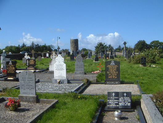 graveyard/cemeterygraveyard/cemetery · 82 yd
 Grave of WB YeatsHeritage attraction · 103 yd
 Drumcliff CemeteryGraveyard · 116 yd
 Saint Columba's Church (Drumcliff)church/chapel · 122 yd
 CastleCastle, unclassified · 1165 yd
 Castle (in Ruins)Castle, unclassified · 1.2 mi
 Floods WoodForest · 1.6 mi
 Kings MountainMountain / peak · 2.0 mi
 Paddy McGowan's WoodWood · 2.1 mi
 Finned PointHeadland · 2.2 mi