What is recorded here
Liscarroll emerged beside a thirteenth-century castle rather than appearing on early market lists, growing into a small village by 1685 and a town of one hundred and twenty mostly thatched houses by 1837. It is easy to picture rope, butter, wool and news moving through narrow lanes while the castle stood watch above them. The town did not need grand recognition to become useful; it gave shape to the land and the land gave back a life busy enough to remember.
Immediately S of castle (14335) and NW of church (14413). Not mentioned in 1299 list of Cork market towns (O'Brien 1993, 94) but settlement likely to have established itself around the outskirts of 13th-century castle (Zajac et al. 1995, 63). In 1685 described as 'a small village' (Johnson 1902, 356). By 1837 contained '120 houses, which are mostly thatched' (Lewis 1837, vol. 2, 280).
The above description is derived from the published 'Archaeological Inventory of County Cork. Volume 4: North Cork' (Dublin: Stationery Office, 2000). In certain instances the entries have been revised and updated in the light of recent research.
Date of upload/revision: 14 January 2009
The monument record does not grant public access. Check the route and ask the landowner before entering private land.
- What survives
- Recorded monument
Places near here
 Battle of LiscarrollMajor battlefield · 17 yd
 Ch (in Rns)Church · 36 yd
 Liscarroll CastleCastle · 104 yd
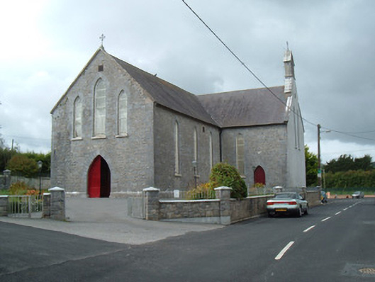 Saint Joseph's Churchchurch/chapel · 220 yd
 LiscarrollArchaeological place · 246 yd
 Liscarroll (Site of)Enclosure · 290 yd
 Windmill HillMountain / peak · 2.9 mi
 Castle (Site of)Castle, unclassified · 3.1 mi
 Lady's WellSpring · 3.1 mi
 Churchtown TrailsVisitor information · 3.1 mi
 Ballyhoura WayWalking route · 4.1 mi
 European YewEuropean Yew · 6.1 mi