What is recorded here
Kilfenora Collapse No. 2 sits at Kilcarragh in County Clare, a recorded cave point rather than a finished map line. The ground there may have failed suddenly, dropping earth into darkness and leaving a hole that people later marked. Whether water dug it or rock simply let go, the place still keeps the moment when the surface stopped being solid.
The Irish Caves Database records Kilfenora Collapse No. 2 at Kilcarragh in County Clare. This point comes from its public cave register. A cave map point does not by itself grant access: check local conditions and ask the landowner where needed.
The cave register does not grant public access. Check conditions and ask the landowner before entering private land.
Places near here
 Sheep foldEnclosure · 351 yd
 CashlaunawoggaCastle, tower house · 601 yd
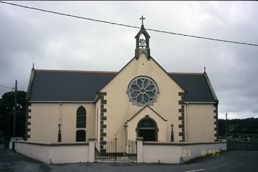 Saint Fachanan's Catholic Churchchurch/chapel · 643 yd
 CrossCross, High cross · 686 yd
 Burren Centre KilfenoraVisitor information · 797 yd
 Saint Fachtnan's Cathedralcathedral · 805 yd
 High CrossHeritage attraction · 830 yd
 Site of Fanta Cas.Castle, tower house · 1.4 mi
 Ballyteigue Nature ReserveNature reserve · 3.2 mi
 Cahermacnaghten CashelHeritage attraction · 4.3 mi
 Cullaun 5 (C5b)Cave · 4.6 mi
 Fergus River CaveCave · 4.7 mi