Overview
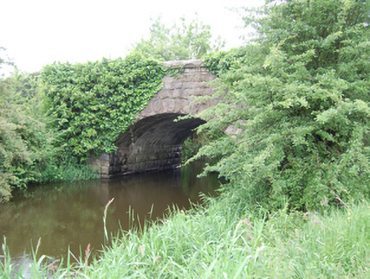
Kilbrackan Bridge is recorded as bridge in Cavan. Single-arch masonry road bridge spanning a watercourse between Glasshouse Lake and Rockfield Lough, built c.1840. Rock-faced ashlar stone abutments, rock-faced ashlar voussoirs with dressed arrises to segmental arch rings, rendered soffit.
Why it was built
The saved account records: Single-arch masonry road bridge spanning a watercourse between Glasshouse Lake and Rockfield Lough, built c.1840.
People and work
The saved account records: Rock-faced ashlar stone abutments, rock-faced ashlar voussoirs with dressed arrises to segmental arch rings, rendered soffit.
How it changed
The saved account records: Rock-faced spandrels, parapet and coping of large projecting stones.
What survives
The saved account records: Squared rubble stone wing walls with cut stone coping, two buttresses to north side of western approach.
Why it mattered
Kilbrackan Bridge matters for the exact reasons given in its official assessment, rather than merely because it is an old structure. The source records: A well-executed stone bridge of simple and functional design. The stonework elevates the simple design with an attractive textural contrast achieved between the rock-faced ashlar and the lines of the arch and projecting coping. Spanning the boundary to Co. Leitrim, Killbracken Bridge is shown on the Ordnance Survey map of 1836, and the Cavan Grand Jury sought funding for a road between it and Killeshandra in 1837. The present bridge appears to be of later nineteenth-century construction, possibly rebuilt by the Board of Works as part of arterial drainage improvements, but may retain wings from the earlier… This explains what the place adds to local life, the street or the surviving built history.
History checked 15 August 2026 against the named sources below.
Add the human story, a picture, a first-hand message or a missing place.
Earn 5 points after the picture is checked and accepted.
Add a pictureAdd its storyTalk or ask a questionAdd a new placeThis official record and map point do not grant access. Most recorded buildings are privately owned; view them only from public ground unless the owner allows entry.
Conversation about this place
Questions and messages sit beneath the source record. They are checked before appearing.
No questions or messages yet.
Ask a question or join the conversation