What is recorded here
Keelmalomvorny is a rectangular megathic chamber in County Kerry, Ireland, built from edge-set slabs that rise no higher than sixty centimetres above the pasture soil. The structure sits ninety metres south of Killemlagh church and faces a low cliff at north and a stream at south, placing the dead between rock and water rather than beneath open sky. Local tradition names Maelmoorney as the buried person, yet the chamber’s shallow depth and exposed position suggest the builders wanted the body reachable, visible, and held within the living landscape instead of hidden from it.
Keelmalomvorny: This site is located in pasture c. 90m S of Killemlagh church and graveyard (KE096-009----) and .25km NE of the beach at St Finan's Bay. It is bordered by a low cliff-face at N and by a stream at S. It was described in the OSNB as the burial place of Maelmoorney (Killemlagh, 32).
A series of slabs set on edge define a level, rectangular area which measures 4.4m ENE-WSW x 3.4m NNW-SSE. Some of the slabs barely protrude above ground surface, while the remainder range up to .6m high and .9m long. The N and S sides are well-defined and are each represented by six slabs. A block-like slab is set slightly askew to the inner face of the S side, and a large boulder appears to form part of the SW angle. Two slabs, spaced 1m apart, form the monument's W end, and adjacent to the inner face of the N slab is another slab, set at right angles. The E end is defined by only one slab, at N, which is almost completely concealed by sod-cover. A second slab and a boulder occur immediately outside this.
At the S side of the orthostatic monument is an irregularly shaped stony spread, two slabs set on edge and a series of at least four stones, the tops of which barely protrude above the sod-cover.
The above description is derived from A. O'Sullivan and J. Sheehan (compilers), 'The Iveragh peninsula: an archaeological survey of South Kerry'. Cork University Press (1996), no. 1474. In certain instances the entries have been revised and updated in the light of recent research.
Date of upload: 1 August 2013
The monument record does not grant public access. Check the route and ask the landowner before entering private land.
- What survives
- Recorded monument
Places near here
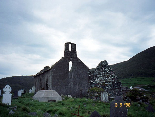
 Cill MhaolmhuirneArchaeological place · 12 yd
 Ogham StoneArchaeological place · 147 yd
 Séipéal na Cille [Killemlagh Catholic Chapel]church/chapel · 159 yd
 Tráigh na CilleBeach / strand · 332 yd
 Cuas a 'ChapaillBay · 478 yd
 Cuas a' PhúcaCave · 484 yd
 Cuas an tSoithighBay · 569 yd
 Tráigh LeagaighBeach / strand · 968 yd
 Suíomh Eaglasta/ Ecclesiastical Site.Ruins · 1269 yd
 KillurlyMountain / peak · 1.1 mi
 Cúm an EaspaigMountain / peak · 1.6 mi
 Tobairin Holy WellSpring · 2.0 mi