What is recorded here
Situated on a level, low-lying landscape. According to John O’Donovan writing c. 1840 Rathmacknee graveyard (WX042-029006-) was within a rath (O’Flanagan 1933, vol. 1, 291) that is depicted on the 1839 ed. of the OS 6-inch map as an earthen bank or double bank surviving NW-NE of the graveyard (ext. diam. c. 100m), but if this is an early ecclesiastical enclosure there is no other evidence of an early origin for the church (WX042-029002-). Alternatively it may be ringwork castle on a site later developed as a tower house (WX042-029001-). It is not visible at ground level in pasture.
Compiled by: Michael Moore
Date of upload: 28 May, 2013
Rathmacknee Great is a likely early-medieval ringfort associated with a nearby graveyard mentioned by John O’Donovan in the 1840s. The site is linked to local tradition of fairy hauntings, as was common with such raths in Irish folklore.
The monument record does not grant public access. Check the route and ask the landowner before entering private land.
- What survives
- Recorded monument
Places near here
 CastleCastle, tower house · 15 yd
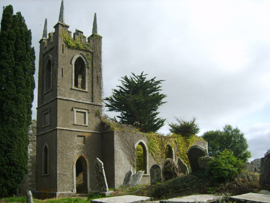 Saint John's Church (Rathmacknee)church/chapel · 43 yd
 Site of ChurchChurch · 58 yd
 bridgebridge · 252 yd
 Not idnicatedChurchyard · 1574 yd
 Johnstown Castle Visitor CentreHeritage attraction · 1.6 mi
 Irish Agricultural MuseumMuseum · 1.7 mi
 Japanese cedarJapanese cedar · 1.7 mi
 American SweetgumAmerican Sweetgum · 1.8 mi
 Ballyrane Castle (in ruins)Castle, tower house · 1.9 mi
 16th Irish DivisionMemorial · 3.7 mi
 1798 Memorial PlaqueMemorial · 3.7 mi