What is recorded here
Kilcarragh is a ruined limestone bawn on high Clare ground, mapped as Cashlaunawogga in 1840 and still called ruins in 1897. Its steep slopes, broad rectangular walls, lost tower corner and hidden middle building suggest a proud local residence rather than a temporary farm. People may have lived there, argued there, watched weather roll across the valley and forgotten the name until surveyors wrote it down.
On high ground with steeply sloping ground to the N and S and good views. Indicated and named ‘Cashlaunawogga’ on the 1840 ed. of the OS 6-inch map and named ‘Cashlaunawogga in Ruins’ on the 1897 ed.
A rectangular bawn (int. dims. c. 26.5m E-W; c. 14.6m N-S) constructed from large, mortared limestone blocks with little evidence for dressing (Breen and Ua Cróinín 1997). The poorly preserved remains of a tower house (CL016-011001-), built of similar material, is in the NE corner. Foundations of a building (CL016-011004-) (c. 8m square) visible on Digital Globe (2011-13) and Google Earth (16 January 2011) occupy the middle of the bawn. A limekiln (CL016-011003-) is built into the S-facing slope under its S side.
Compiled by: Mary Tunney and Lynda McCormack
Date of upload: 1 February 2022
The monument record does not grant public access. Check the route and ask the landowner before entering private land.
- What survives
- Recorded monument
Places near here
 CashlaunawoggaCastle, tower house · 19 yd
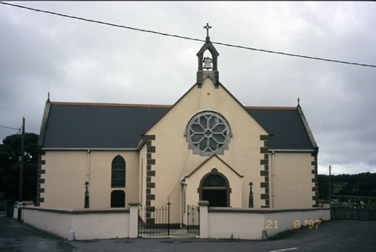 Saint Fachanan's Catholic Churchchurch/chapel · 274 yd
 CrossCross, High cross · 275 yd
 Ecclesiastical enclosure in KilfenoraEcclesiastical enclosure · 330 yd
 Saint Fachtnan's Cathedralcathedral · 413 yd
 High CrossHeritage attraction · 432 yd
 Burren Centre KilfenoraVisitor information · 457 yd
 Caherminnaun Castle (in ruins)Castle, unclassified · 1.2 mi
 Ballyteigue Nature ReserveNature reserve · 3.0 mi
 Cahermacnaghten CashelHeritage attraction · 3.9 mi
 Cullaun 5 (C5b)Cave · 4.3 mi
 Cullaun 5 (C5)Cave · 4.4 mi